Peru Travel Guide
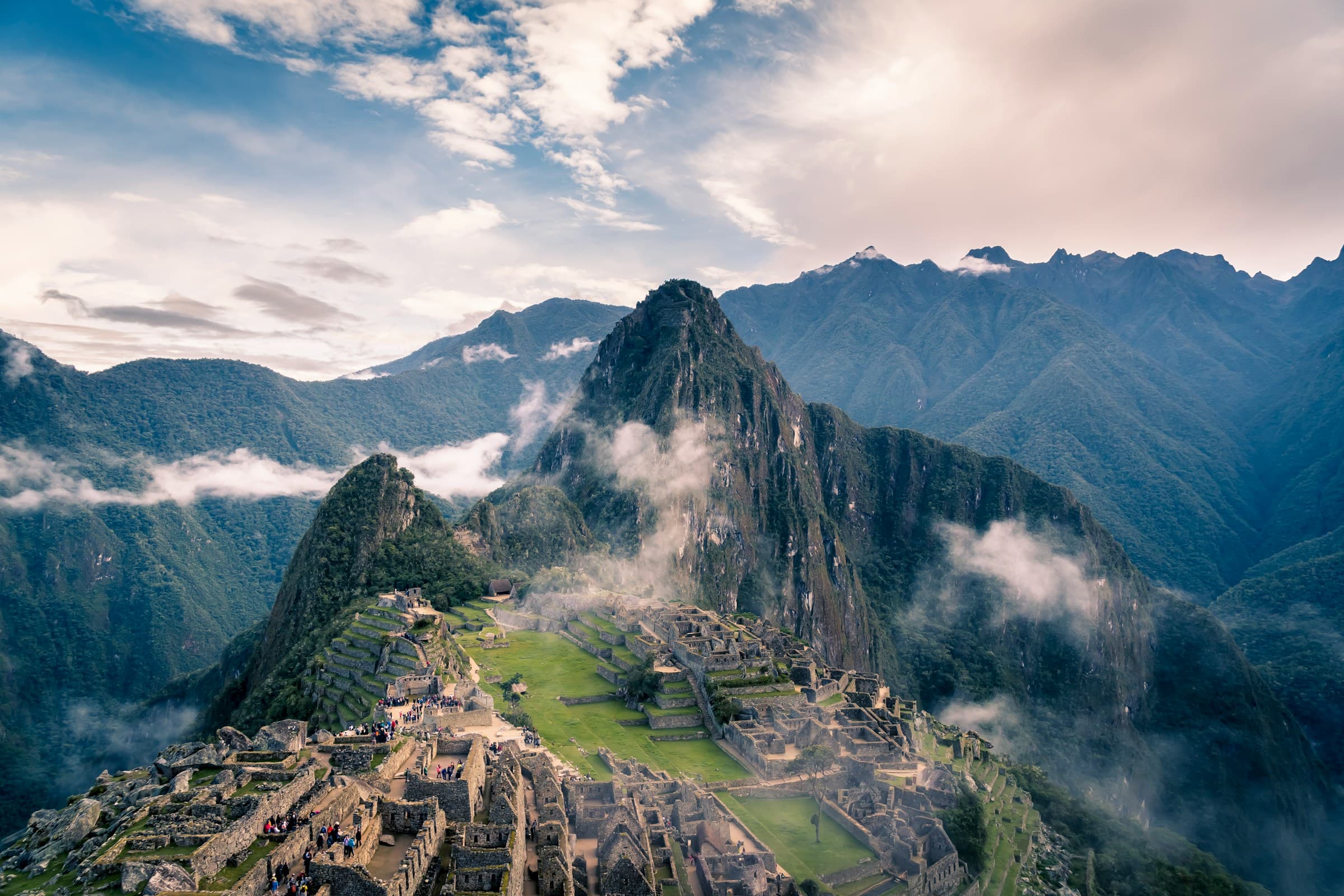
Peru’s culture is a combination of ancient Andean civilizations and Spanish colonialism. Geographically, you’d be hard-pressed to find another country with as much variation as Peru. Peru has stretches of Andes Mountains and Amazon rainforests. It also boasts coastal deserts, highland plains, alpine lakes, and cloud forests. Northern Peru has fascinating archaeological sites, and all over Peru you’ll find fresh, cutting-edge cuisine.
About Peru
Peru is located in western South America, between Chile and Ecuador. It also shares borders with Bolivia, Brazil, and Colombia, and the Pacific. The country’s total size is 496,230 square miles (1,285,220 sq km), which is about three times the size of California. Peru’s diverse landscape includes lush river valleys and arid deserts, snow-capped mountains , and colorful cloud forests and rainforests.
Browse our best hand-crafted itineraries
Get inspired and explore our curated collection of hand-crafted trips. From romantic honeymoons to family adventures, every itinerary is completely flexible and tailored to your needs.
Family Expedition Across Peru
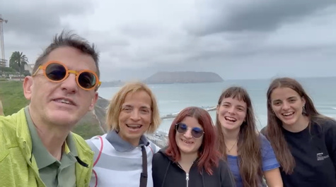
Elisa and her Greek family explored Peru’s diverse landscapes on a memorable 20 day adventure. They journeyed from the Paracas desert and Huacachina dunes to the high Andes of Arequipa, Colca Canyon, Lake Titicaca, and Machu Picchu. Friendly local guides shared traditions and stories, letting the family feel Peru’s warm hospitality and leaving them with a deeper appreciation for its vibrant heritage.
Peru
Andean Peaks to Lake Titicaca
The Anywhere team was planning and helping us thru out the process. Right from picking us up from the airport to dropping us back to the hotel. They created a WhatsApp group to communicate with us every day and answered our questions within a few minutes. Thanks to Lisbeth and Jose in Cusco. Eduardo in Machu Pichu, Anna Maria in Puno and Sara and Samuel in Lima. They are worked like a team to ensure our trip was well planned and executed. Big thanks to Cesar for the great planning and suggestions along the way.
Peru
Excursion Together
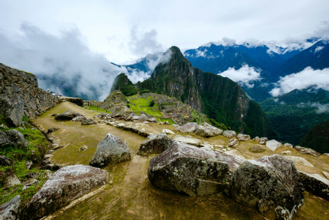
Laura explored Peru’s diverse landscapes on a curated 10‑day adventure that blended culture, history, and nature. She began in Lima’s coastal desert, visited the Palomino Islands for sea‑lion spotting, then trekked the high‑altitude ruins of Cusco and the Sacred Valley before sailing on Lake Titicaca’s shimmering plateau. Guides shared local customs and stories, letting her taste dishes and feel the timeless rhythm of Peruvian life, leaving her with an appreciation for the country’s vibrant heritage.
Peru
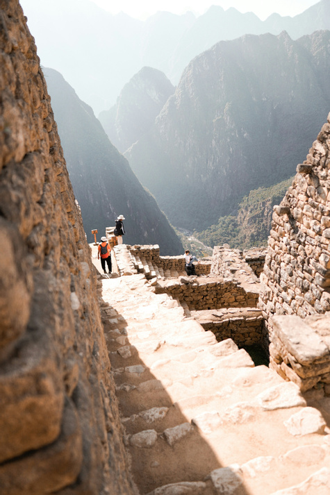
Peru for Two: Lima, Cusco, the Sacred Valley & Machu Picchu
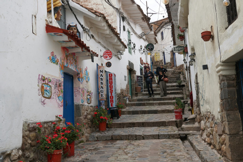
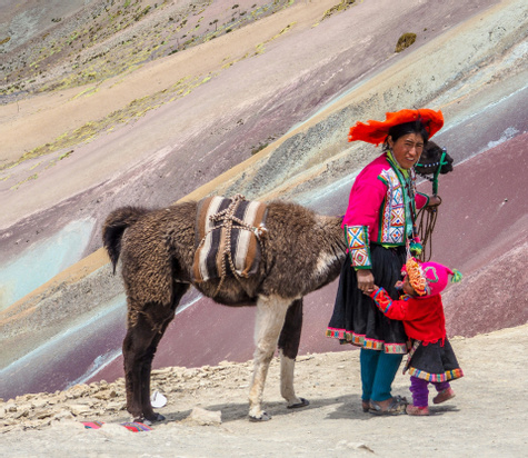
Embark on a vibrant Peruvian adventure where bustling city life meets ancient Andean wonders, contrasting modern Lima’s coastal energy with the mystique of the Sacred Valley. You'll wander Lima’s historic streets, then soar to Cusco’s high-altitude charm before trekking to the misty ruins of Machu Picchu and the colorful heights of Vinicunca Rainbow Mountain. Guided by knowledgeable locals, you'll taste traditional cuisine, hear Andean legends, and leave with a deeper connection to Peru’s rich heritage and breathtaking landscapes.
Peru
Our Multigenerational Journey
My sister and her family want to come next year, and possible another friend's family as well, so will definitely tell them to use Anywhere!!!
Peru
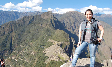
We Conquered Huayna Picchu
This was a very personal experience and Anywhere.com does an amazing job of having agents who are cultured and/or very familiar with the country to which you wish to visit. This allows the agent to listen to what you want to experience and then match you up with the right outfitter, vendor, excursion group, etc...I felt like Sara Nizama truly listened to my wants/needs and made them a reality. I am so happy with my Peru experience, thanks to Sara and her team. I want to go back soon and explore more of Peru with the help of Sara and her team. Thank you!
Peru
Wow, We Did it!
Excellent coordination and very helpful staff throughout the trip. Sara is the boss...she has good command of all aspects of our trip and provided the necessary help & support ...right from planning stage to boarding our flight back to US.
Peru
Experience The Heart of Peru
Very professional service, very good organization overall. Everything went smoothly. We ABSOLUTELY will recommend Anywhere.com to our friends. And for our future trips, we will first look at what anywhere.com is offering before looking elsewhere.
Peru
Romance in The Andes
After debating on which country to visit for our special trip, we finally decided on Peru. It was the best decision ever. Anywhere.com helped us arrange and make the most of our dream vacation!
Peru
Inca, Lake, & Culture Family Adventure
We were blown away by the beauty of the country—from the highland Lake Titicaca to the cultural experiences at Arequipa. We were so impressed with the Machu Picchu experience...we have to come back and explore more of Peru!
Peru
An Epic Peruvian Family Journey
Peru is bursting with history, interesting sites and friendly people and tourists from all parts of the world. We wished our hotels were a bit better and should have requested upgrades for a reasonably higher price. We have already recommended Peru to family and friends. Our photos and videos on Facebook have evoked several inquiries. I would certainly like to visit Peru again along with other countries of South America.
Peru
A Quick Machu Picchu Getaway
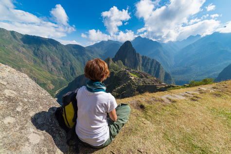
Peru was a great place to visit. I had nothing but great experiences.
Peru
Culinary Delight and Family Adventure
I learned so much of it's history and have such respect for it's culture.
Peru
Peru From Amazon to Andes
As my daughter put it: this is the most beautiful place that I have ever been to
Peru
The best places to visit in Peru
From iconic landmarks to hidden gems, explore the Peru destinations our local insiders recommend most.
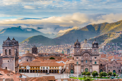
Cusco
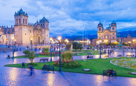
Nestling in the dip of the Watanay River Valley, from above the city of Cusco takes the shape of a puma, which some historians theorize was a purposeful design. As the city expands, its borders creep up the sides of the surrounding mountains, but puma statues, fountains, and signs keep the big cat’s status of unofficial city mascot.
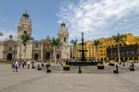
Lima
The coastal city of Lima is diverse, with colorful parks, friendly locals, tasty cuisine, vibrant markets, and ancient historical attractions. Travelers can tour world-class museums, wander through the colonial architecture of Miraflores, and eat seafood along the Pacific coast.
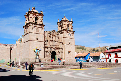
Puno
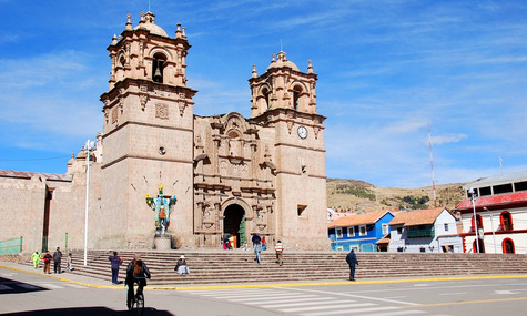
Puno is Lake Titicaca’s only major city, and most travelers will pass through here while heading towards other destinations around the lake. The city is only mildly attractive, but is surrounded by seriously spectacular scenery.
Aguas Calientes
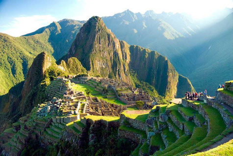
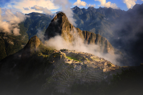
Aguas Calientes is the closest town to Machu Picchu. Staying here for a night or two will give you intimate access to this incredible Inca site.
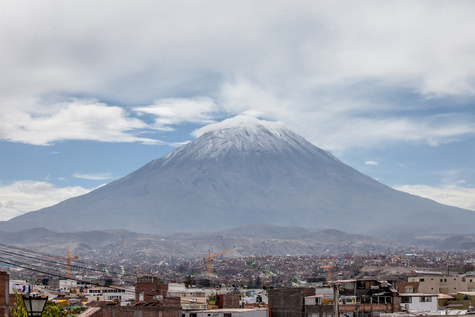
Arequipa
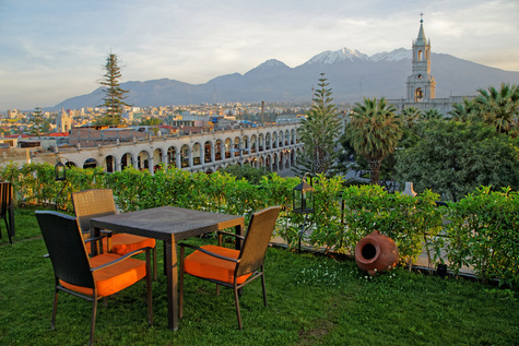
The name Arequipa comes from "Ari, Quepay," which means "Yes, you may stay" in the local Quechua language. Not surprisingly, Arequipa is very welcoming and well worth the visit with its amazing architecture, bustling city center, and friendly atmosphere.
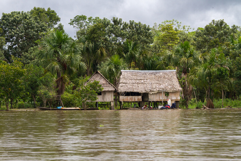
Iquitos
Iquitos is a city in Peru’s northeastern Amazon. It’s been on the tourism scene since the 1960s and has well-established services for travelers. You can also visit Iquitos year-round, which isn’t always possible in other parts of the Amazon.
The Sacred Valley
The first inhabitants of the Sacred Valley treasured this land not only for its dramatic landscapes and sweeping vistas—the Sacred Valley also offered ample opportunities for agriculture, and had plentiful water just beyond the reaches of the parched desert. Its fertility was the result of a sunny climate and the Río Urubamba coursing through the valley.
Nazca
The south coast of Peru was home to extraordinary pre-Columbian civilizations, including the Nazca, who are best remembered for their cryptic geoglyphs: huge line pictures of animals, etched across 190 square miles (500 sq km) of desolate desert land. The Nazca lines can be seen via a plane tour, or in part from nearby hills.
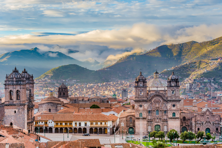
Visiting Peru
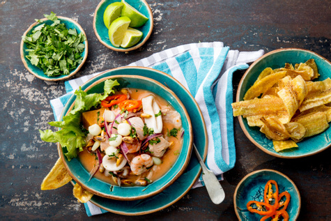
From the well-known Inca and Nazca (the cultures responsible for Machu Picchu and the Nazca Lines ,) to the lesser known Moche, Chavín, Caral-Supe, Paracas, Wari, and Chimu cultures, Peru has produced a stunning range of civilizations. And for better or worse, the arrival of the Spanish in the early 16th century changed the cultural fabric of Peru for good. All of these cultures produced fascinating art. Meanwhile, Peru’s landscape and immigrant cultures create an eclectic palette for Peruvian chefs. From sampling fresh ceviche along the coast to visiting Inca ruins in the highlands , your trip here is sure to be one of your most memorable.
When is the best time to visit Peru?
May to September is the best time for most Peru trips: it's the dry season in the Andes, with sunny days and cold nights around Cusco, Machu Picchu and Lake Titicaca. June to August is peak season, so book Inca Trail permits, trains and hotels well ahead; May and September bring similar weather with fewer people.
- Andes (Cusco, Sacred Valley, Machu Picchu, Puno): dry May–September; rainy December–March. The Inca Trail closes every February for maintenance.
- Amazon (Puerto Maldonado, Iquitos): short bursts of rain year-round; driest June–September, when wildlife stays close to the rivers; wettest December–April.
- Coast (Lima, Paracas): hot and sunny December–March; grey garúa fog April–November. The North Coast (Máncora) is warm enough to swim year-round.
Plan a multi-region route with a Peru Insider , or browse Peru vacations .
Coastal Climate & Terrain
The climate in Peru is dependent on the landscape, as well as the Humboldt Current and northwest jet stream. The arid Peruvian coast runs some 1,500 miles (2,400 km), from Ecuador to Chile. Along the southern section of the coast is the Atacama Desert, one of the planet’s driest places. Peru’s coastal regions see very little rain, although it does drizzle from time to time. Coastal cities also get hit with fog, which is known locally as garúa and is the result of cold coastal air trapped between warmer currents. This fog typically happens from April to September. The hottest months along the Peruvian coast are from December through March.
Mountain Climate & Terrain
The Andes run down the center of the country, forming the second highest mountain chain on earth. The tallest mountain in Peru is Huascarán, which tops out at an elevation of 22,205 feet (6,768 m). In the Andes, the weather can be cold and chilly, with overnight lows well below freezing. The dry season lasts from June to August, and the rainy season lasts from December to March.
Between the Andean mountain ranges are fertile valleys where about half of Peru’s food is produced. This is the area that was terraced and irrigated by the Inca to grow crops like corn, quinoa, and potatoes. These highland areas have similar seasonal shifts to the Andes.
Amazon Climate & Terrain
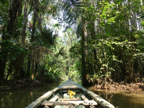
On the eastern side of the Andes is the Amazon Basin . At high elevations, misty cloud forests form some of the country’s most biodiverse ecosystems. As you go lower, you hit lowland rainforests and huge, muddy rivers. The Amazon can see rain throughout the year, but the rain usually only lasts for a few hours at a time. The rainiest time of the year is from December to April. The driest months are from June to September.
Cultural History
Peru was once the seat of several indigenous civilizations, most notably the Inca. The Spanish arrived in the 16th century and conquered these local civilizations. Nearly three hundred years later, in 1821, Peruvian independence was declared.
Military rule took place during some of the 20th century, but the country eventually formed a democratic leadership in 1980, although insurgencies and economic downturns continued to haunt Peru throughout the 80s. In 1990, President Alberto Fujimori was elected and ushered in a decade of economic progress, alongside some authoritarian measures. Recent elections in Peru have seen democratic, market-oriented policies return to the forefront. Read More
Society & Economy
Peru’s population, which hovers around 30 million, is fairly diverse. Just under half of the population is Amerindian, around 37 percent is mestizo (any Amerindian and white), and 15 percent is white. Japanese, Chinese, black, and other ethnic groups make up around 3 percent of the population. Urban and coastal communities have experienced reaped more economic benefits than have rural and indigenous groups in the Amazon and Andes.
Peru has a stable, democratically elected government and a strong economy. All Peruvians are required to vote from ages 18 to 70 — in fact, people that don’t vote can be fined. The weakest part of the Peruvian government has traditionally been the judiciary branch, which has been charged with widespread corruption.
The Peruvian economy is strong. In 2013, the economy grew at a rate of 5.1 percent and the GDP was $210 billion; it’s also had low inflation for several years running. The Peruvian economy owes its strengths to natural resources, most notably mining. Large-scale mining projects have, however, been met with widespread local opposition from groups who claim to receive little benefit from the mines. Other important aspects of the Peruvian economy include manufacturing, agriculture, banking, and retail services. Read More
Peru Travel FAQs
Does Peru get hurricanes?
No. The cold Humboldt Current keeps Peru's Pacific waters too cool for hurricanes to form. The hazard to plan around is earthquakes: Peru sits where the Nazca Plate pushes under South America, and tremors are fairly common, especially around Lima. If strong shaking starts, drop, take cover and hold on; outdoors, move to the marked safe zones (signs with a large 'S'); at the beach, head for higher ground, as a tsunami can follow. El Niño years can also bring heavy rain and flooding to the coast. Your Peru Insider tracks conditions throughout your trip.
What documents do I need to enter Peru?
U.S. citizens need a passport valid for at least six months after arrival and proof of onward or return travel; no visa is needed for tourist stays of 90 days or less, and the border officer sets your permitted stay (as of September 2026). Lima's US$30.24 international departure fee is normally built into your airline ticket, but connecting between two international flights in Lima adds a US$11.86 transfer fee paid separately. Don't try to take home archaeological artifacts or fossils: exporting Peru's cultural heritage is prohibited. See Peru entry requirements .
Where are the best beaches in Peru?
On the North Coast, the one stretch of Peru that's warm and sunny enough for beach days year-round. Máncora is the lively surf town with steady waves; Punta Sal and Vichayito, just south, are quieter and better for swimming, kayaking and resort stays; Los Órganos has a broad white-sand beach, good surf and deep-sea fishing for mahi-mahi, tuna and marlin, best in July–August and December–April. Near Trujillo, Huanchaco pairs a mellow beach with fishermen riding reed caballitos de totora. See the Peru surfing guide or add a beach finale when you plan your Peru trip .
Should I rent a car in Peru?
Usually not. Distances are long and mountain roads slow and winding, so Peru works best with domestic flights between regions and private drivers within them; Lima to Cusco, for example, is a flight rather than a drive. By private transfer, allow about 1.5 hours from Cusco to Ollantaytambo in the Sacred Valley and about 4 hours from Lima to Paracas. Tourist routes have the best roads; rural roads add time. See private transfers in Peru and getting around Peru .